Mauka to Makai
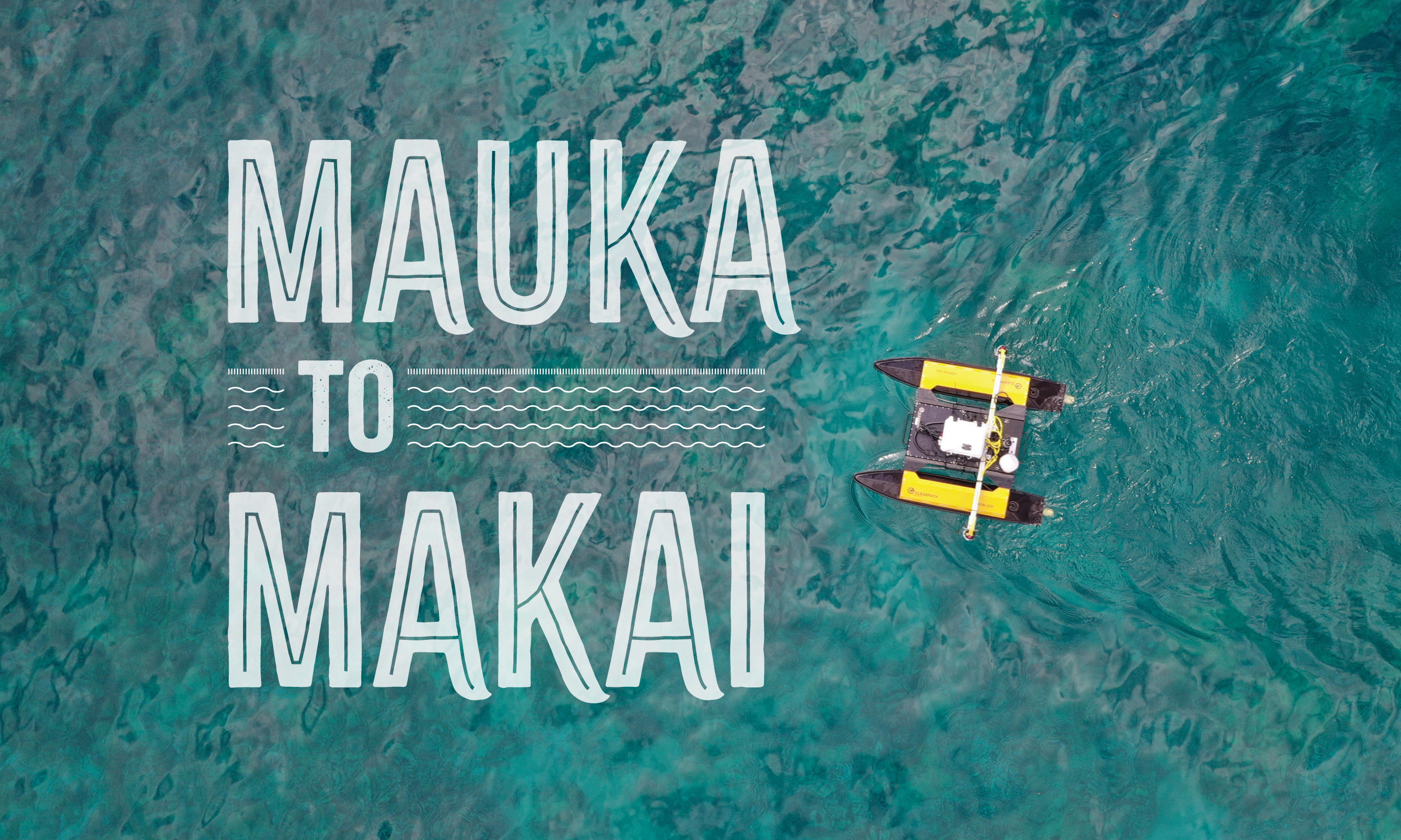
From mountaintop to ocean floor, a BYU team is helping save the reefs of Molokai.
By Brittany Karford Rogers (BA ’07) and Julie Harker Walker (BA ’93) in the Spring 2023 issue
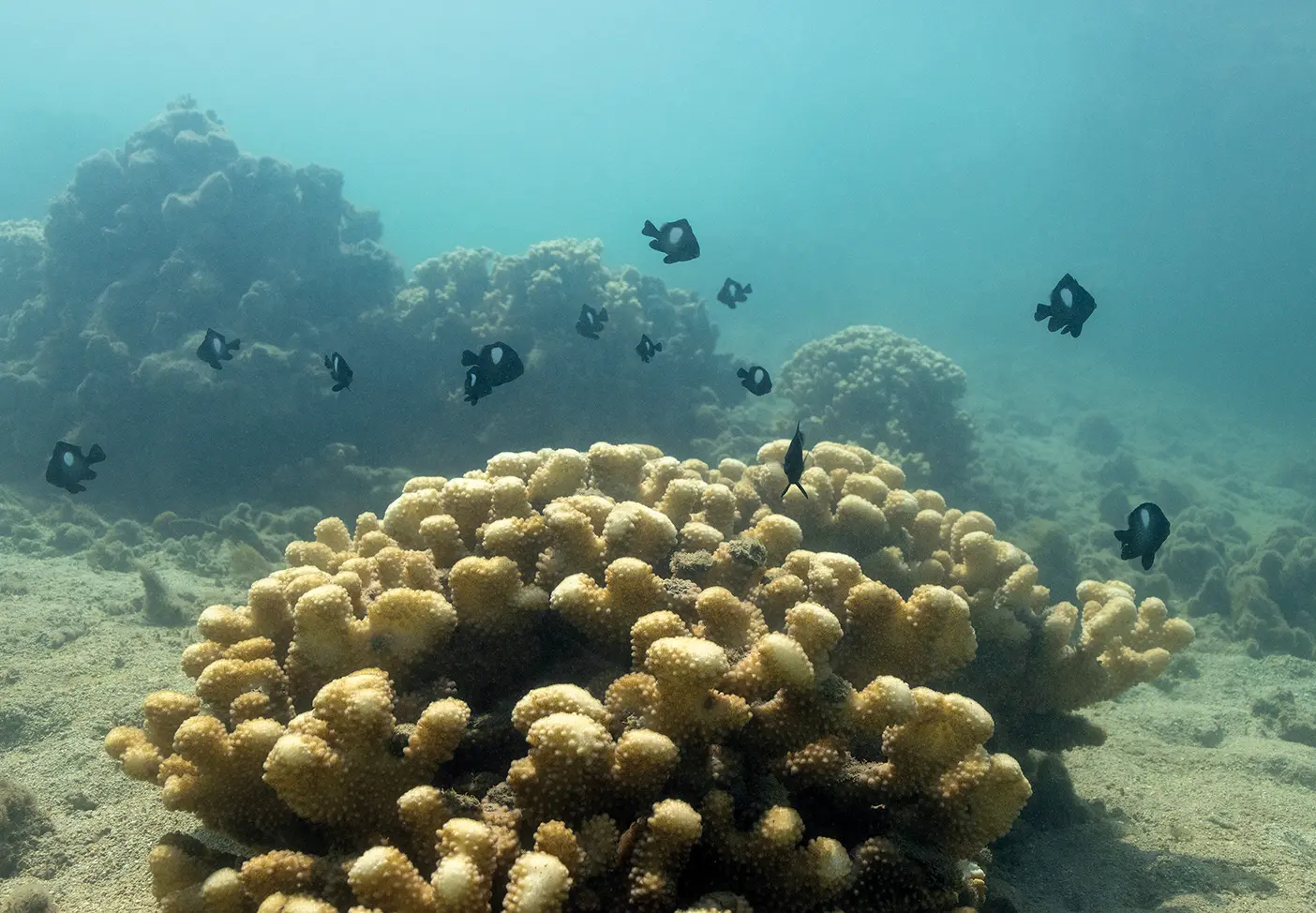
Some spread out like giant green pancakes; others are nubby fingers, twisting upward, splaying for sunlight.
Where they are healthy, the corals on Molokai’s fringing reef “mound into massive green castles, green citadels,” says BYU biology grad student L. Kala‘i Ellis (BS ’20, MS ’22). Indeed, these corals form an underwater fortress: the reef here tempers the ocean, dissipating storm surge, protecting the people on shore.
The importance of this fringing reef can’t be overstated, says Ellis, from its biodiversity to its value as a habitat for the fish locals depend on. Fringing reefs grow seaward directly from the seashore, and this relatively shallow, lagoon-like expanse of coral in Molokai, Hawai‘i, makes up the largest fringing reef in the United States.
“But right now it’s at risk,” he says. “It’s at risk of being lost.”
While reefs worldwide are threatened by ocean acidification, overfishing, and coral bleaching caused by warming waters, Molokai’s reef faces an additional danger—dirt.
“The students who come here leave with a little bit of Molokai in their heart, transformed in how they see their role in the world.”
—Rick Gill
For decades upland sediment has eroded and run off into the ocean, muddying the water and blocking out the sunlight coral requires to grow. In 2019 the Molokai-based conservation nonprofit ‘Āina Momona called on BYU, in landlocked Utah, to partner in finding solutions.
Since then an interdisciplinary team has brought nearly 50 BYU students to this island to take what Hawaiians are observing anecdotally and give it quantitative teeth.
The work involves aerial and—more challenging—underwater surveying, putting BYU engineers and biologists in the same boat, sometimes feeling nauseous in the middle of the Pacific Ocean, diving down 25 feet to collect sediment samples.
The game changer: a BYU-built autonomous robot that not only collects samples but also creates a geotagged 3D map of the reef detailed enough to distinguish between individual coral colonies. The map will serve as a baseline from which ‘Āina Momona can track further reef degradation or—they hope—successful mitigation.
Beyond the deliverables, this project puts students in a place that changes them, says BYU biology professor Richard A. Gill (BS ’93). It’s exactly the kind of inspiring learning that BYU exists to instill. “It takes their learning and inspires them to apply it,” he says.
“All of the students who come here leave with a little bit of Molokai in their heart, transformed in how they see their role in the world.”
A Chiefly Invitation
This is our icebox,” says Molokai resident Kalani Johnston, gesturing to the reef; most who call this rural island home subsist largely on what they catch. “My grandfather always told me, ‘If you’re not moloa—if you’re not lazy—you’re not going to make—you’re not going to die.’” In short: the fish have always been plentiful.
At least they used to be.
Molokai locals have long noticed changes on the reef, from depleted catches to excessive algae to murky brown waters where it used to be clear to the seafloor. Once, Johnston could fill a bucket with crabs by walking 100 yards on the beach. Now he covers a mile to collect a dozen. “It’s spooky,” he says.
“My friends and family who have spent their lives on Molokai, they know what is happening,” says BYU–Hawaii president John “Keoni” S. K. Kauwe (BS ’99, MS ’03), who grew up on the island and now sits on the ‘Āina Momona leadership team. “But moving forward, we’re going to need support from government and nongovernment agencies to come up with meaningful solutions. . . . Those agencies require carefully collected, rigorously analyzed scientific data.”
That’s where BYU comes in.
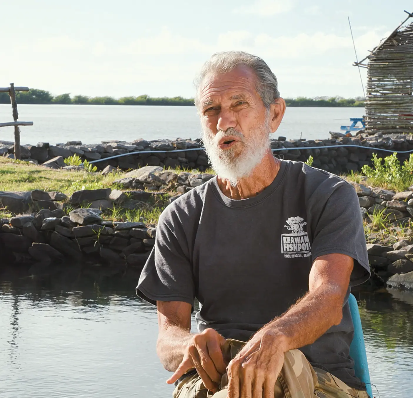
Walter Ritte, founder and president of ‘Āina Momona, asked Kauwe for ecological-research expertise, and Kauwe, a former BYU biology professor, referred him to Gill.
Gill cultivated a love of the Pacific long ago as a Samoan-speaking missionary in New Zealand—and he was already mentoring a student on a reef-health project in Samoa.
Ritte’s invitation to Molokai, says Gill, “was like being invited in by one of the great high chiefs in the Hawaiian system”—Ritte is renowned across the isles for his activism, part of the “Kaho‘olawe Nine,” who protested military practice bombings on Kaho‘olawe in 1976. He continues conservation efforts to this day, restoring native vegetation and working to revive Molokai’s Keawanui Fishpond, an example of the sustainable coastline aquaculture that fed Hawaiians for centuries.
At present the pond is full of mud.
“It’s going to take a lot of work in order to solve the situation,” says Ritte. But with the tools from BYU, he is hopeful.
This sediment slide is, after all, a modern problem, the product of current land use and management. Today one state entity oversees the land, another the water—it’s all “sideways,” says Ritte.
In contrast, ancient Hawaiians managed things top to bottom through the ahupua‘a system, dividing the land almost like a pie, each slice stretching from the mountaintop to the ocean—mauka to makai.
“Implicit within that design,” says Gill, “is the recognition that what happens in the ocean is a byproduct of what happens on land.”
Ritte repeats this tenet often: “Everything mauka impacts makai.”
To help this reef, BYU had to go to the mountain.
Mapping the Mountain
The work is personal to Ellis, the lead student researcher on the project; his great-grandmother Mary Lee—or “Molokai Grandma” to family—lived here, on the mountain. Ellis’s dad visited her every summer on Molokai.
Ellis never met Molokai Grandma, but she looms large in local lore as an activist alongside Ritte.
“I always heard of this woman who fought and protested with aloha, with love,” says Ellis. Her legacy helped guide his choice of fields of study.
Drawn naturally to biology, Ellis enrolled in a BYU geospatial-analysis class “on a whim” as an undergrad. His mind, he says, was blown.
“It opened up all the ways mapping can be leveraged for conservation,” he says.
He went on to minor in geographic information systems. Little did he, a native Hawaiian from Oahu, know he’d end up using it in his own backyard.
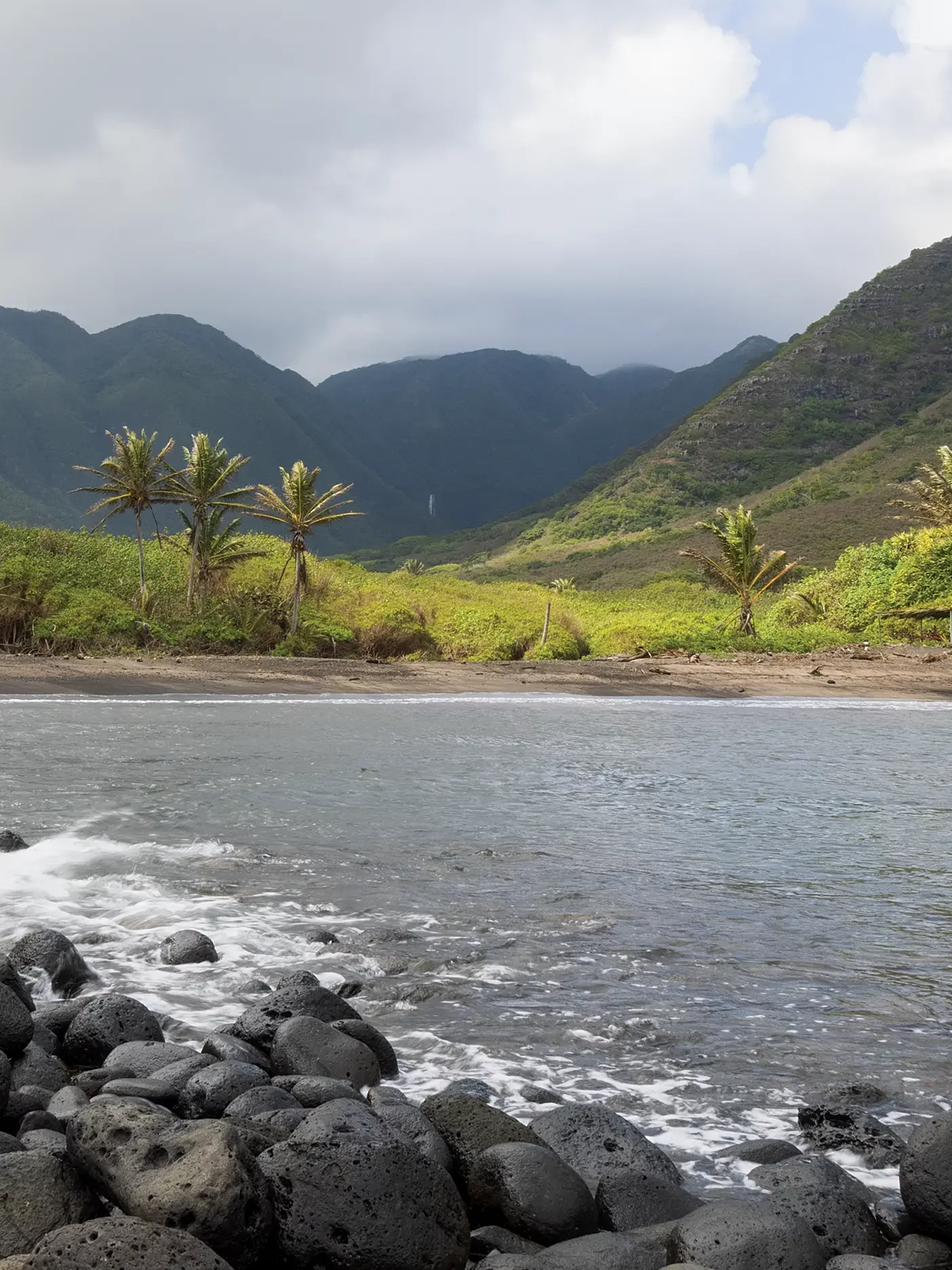
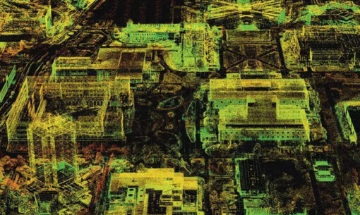
Piloting drones “with the ability to obtain imagery at the centimeter scale,” Ellis captured almost 10,000 images of the mountainside that, stitched into a single image, create a dynamic 3D map that zooms down to individual plants that can be identified by species.
What’s more: with data collected three times over three years, Ellis can run change-detection visualizations, revealing the most egregious pathways of soil off the island.
The most vulnerable spots: overgrazed slopes and livestock trails. The trails wash out in heavy rainfall.
The BYU team was there for one such storm: “The roads were covered with as much as a foot of soil,” says Gill. “That’s material that ultimately ends up in the ocean.”
Multispectral imaging also incriminated the kiawe tree, a thorny invasive shrub that has spread all over the island. “It doesn’t hold the soil the way that native grasses do,” says Ellis. His 2022 master’s thesis recommends locations for the construction of strategic ditches and dams, as well as exclusion fencing for livestock.
Going Deep
Simultaneously, the BYU team trained its attention on makai.
The biologists first attempted to get a visual on the reef by strapping an underwater camera to the bottom of an “intern-powered” paddleboard. “You just push and kick,” says Ellis, laughing.
Here, and throughout, they were grateful to Ritte and others for sharing their keen knowledge of the area—like avoiding a particular test site because “an antisocial 14-foot shark” hung out there. The advice came via Kalani Johnson, a local farmer, fisher, and expert on the ecology of the area due to generations of experience. “When we fish over there, we occasionally have to discourage her with a poke on the nose,” he told Gill. “I don’t want you coming back with one fewer student.”
They captured images at 23 different locations off Molokai’s 28-mile south shore, free diving for water and sediment samples. The sediment travels home with the team for analysis in BYU labs, where they separate particles into “terrestrial and marine,” says biology PhD student Tava‘ilau “Stau” Segi (’23).
The tell? “It’s the size and the color of the particle,” says Segi. Ocean-sediment particles are bigger. Particles from the land are small silts and clays with the ruddy red of the iron-rich soils.
In the water samples, they measured pH, salinity, and turbidity—the clarity of the water. Turbid water is doubly bad for coral—it disrupts photosynthesis and is packed full of fertilizing nutrients. “Algae loves that,” says Segi. Algae and coral compete for space, he explains, and algae always wins, leaving bleached coral below.
This method of data collection is difficult.
For one, gathering samples is exhausting. The students have to spell each other; Segi, from Samoa, and Ellis could stay underwater for a minute or two, the mainlanders, up to 30 seconds. “People get fatigued,” says Ellis.
Also, water currents made precise mapping impossible. They’d start at specific GPS locations, but their results provided a sampling of a general area at best.
“It didn’t allow us to answer questions at the same scale that we were able to answer on the mountainside,” says Gill.
So they called in the engineers.
Robot on the Reef
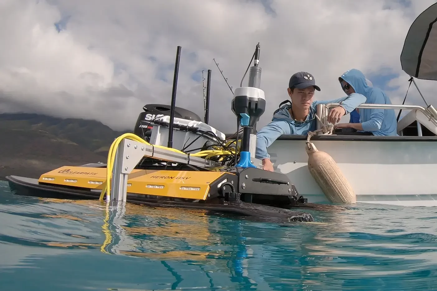
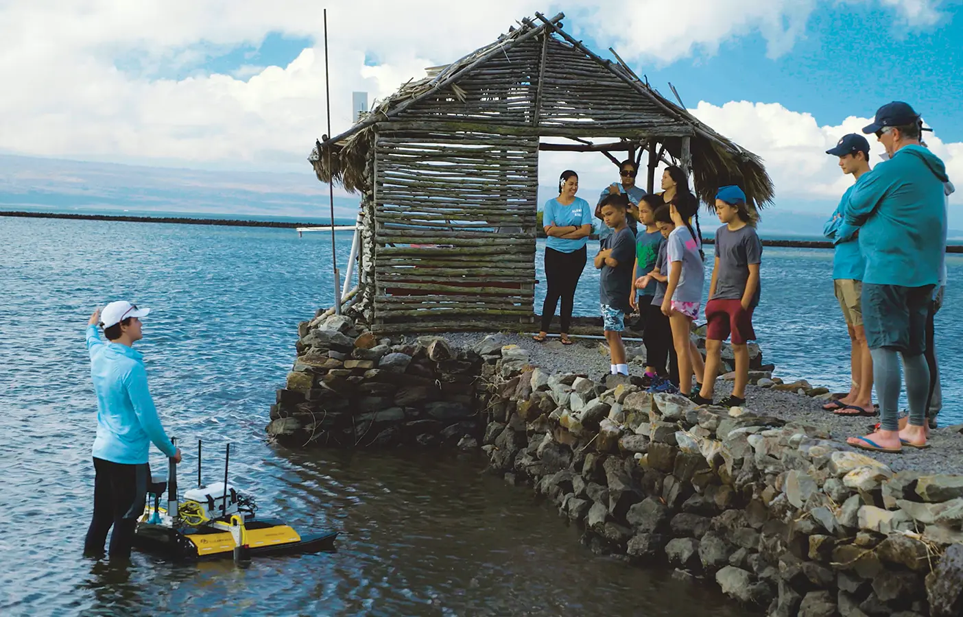
While the biologists pushed the paddleboard, a team of BYU engineers got to work on an autonomous surface vehicle (ASV) that could scan and then model the reef in 3D.
BYU happens to be a leader in autonomous navigation. The Field Robotic Systems Lab, led by BYU electrical and computer engineering professor Joshua G. Mangelson (BS ’14), is working at the edge of what’s currently possible, trying to teach robots to perceive.
“For example, telling it to go find a specific type of coral and have it do that, to act intelligently out in the environment,” says Mangelson. “That’s not a capability that currently exists.”
Their Molokai ASV is giving them data to play with, to train up the AI.
It looks like a robot on water skis. The double-hulled ASV is about the size of a child-sized dinghy, weighing in around 80 pounds. Via a receiver the vehicle receives GPS coordinates that are added, in real time, to every piece of data it collects. This allows biologists to check in on exact locations year to year, keeping tabs on the coral over time.
But first they had to test it in Utah. They lugged it up to try out on glacier lakes in the Uintas—the closest parallel they could find to Molokai’s turquoise waters.
While the technology makes it effectively an aquatic drone, the algorithms that guide the vehicle are magnitudes more complicated on the water than they are in the air.
“The marine environment is just a lot trickier,” says Mangelson. They feed the robot a trajectory, but it has to recalculate constantly, combining its current location and present motion—all while bouncing atop ocean waves. For a perfect 3D reef reconstruction, the ASV must follow tidy lines and make tight turns as its stereo camera takes photos rapid-fire.
Electrical and computer engineering PhD student Derek R. Benham (BS ’21) describes it as a “lawn-mower pattern.” To build the 3D model, each image needs to overlap 70 percent with the previous one.
For a perfect 3D reef reconstruction, the drone must follow tidy lines and make tight turns as its stereo camera takes photos rapid-fire.
On the ASV’s first day on Molokai’s reef, everyone was nervous, the engineers huddled with the biologists on a nearby boat, tweaking algorithms right up to go time.
But it was all ho’ailona, says Ellis. It’s a Hawaiian term, he explains, for a good omen, a sign—a blessing. And the signs, he says, were everywhere.
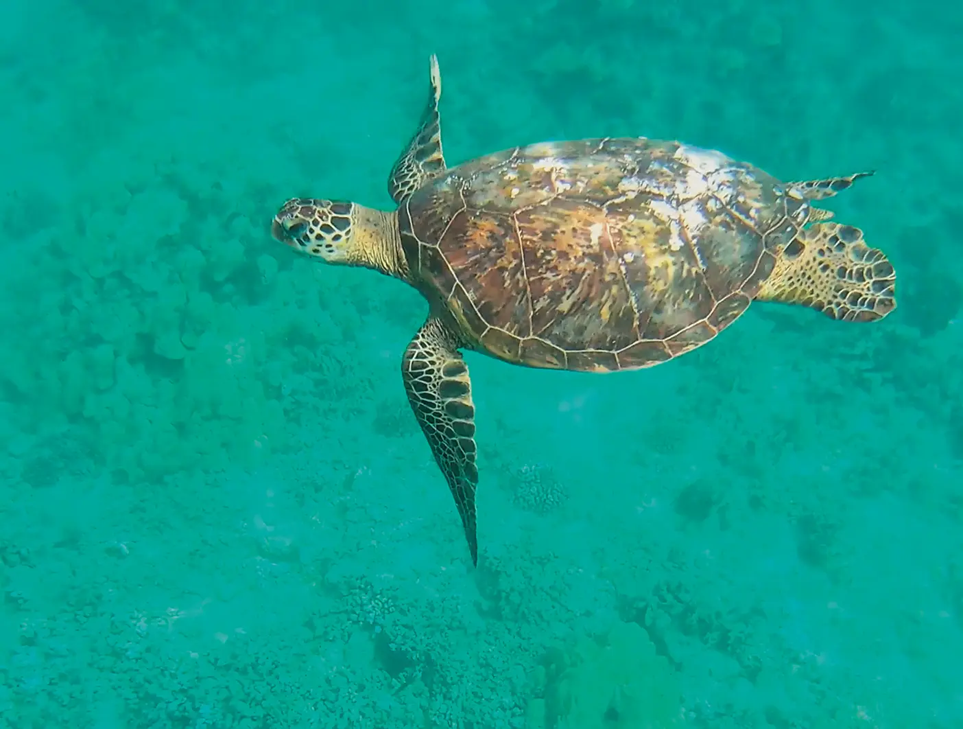
The ocean was like glass—perfect for clear imaging. They spotted a glide of flying fish sailing in and out of the water. Then a pod of 50 spinner dolphins spontaneously appeared around their boat as they motored to their first transect. When the ASV battery was exhausted and they had to swim out to fetch the vehicle, a massive sea turtle swam up to escort them.
“We took that as a special sign,” says Ellis. “The work we’re doing is important, significant.”
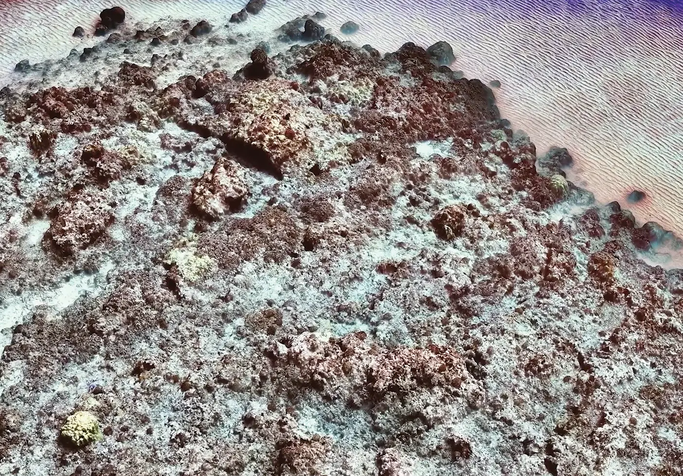
In just one day the team captured 20,000 pictures. The best part: “Seeing the autonomous rover work its magic, seeing the data, seeing the images pop up—just everyone’s faces light up,” says Ellis. And they found a cache of pristine coral bathed in light, “with perfect clarity, perfect visibility, with fish darting in and out.
“That,” continues Ellis, “is the ideal.”
Diving In
The baseline reef model is finished, but the work is only expanding.
“That first robot was our training wheels,” says Gill.
This summer he and Mangelson will take students to Oahu to work on a similar project, this time with two robots: the fleet now includes an autonomous underwater vehicle (AUV). It opens new research possibilities—and “cranks up the dial of difficulty,” says PhD engineering student Easton R. Potokar (BS ’20, MS ’22).
They plan to take the technology to Samoa too, to the reef Segi grew up on.
The waves of the project keep rolling in, allowing students to collaborate across disciplines, solve and re-solve, and serve.
Back at the Y, students continue to process the Molokai data, using machine learning to teach the robots to recognize and differentiate between coral species. What would otherwise be standard classroom exercises now have something at stake. “It’s been really awesome to see these things that I’ve learned in classrooms actually applied out on the water, in places where it’s useful and helpful to people,” says Potokar. “It’s made me realize how important the things I have learned are.”
That’s when everything starts to connect, says Ellis.
“It’s one thing to learn about [science] in a classroom, to watch videos, to read about it, but not until you actually feel like you’re making a difference—that’s when things start to click, that’s when people start to change, that’s when you have this spark in your mind and your heart that says, I want to do this.”
Feedback Send comments on this article to magazine@byu.edu.