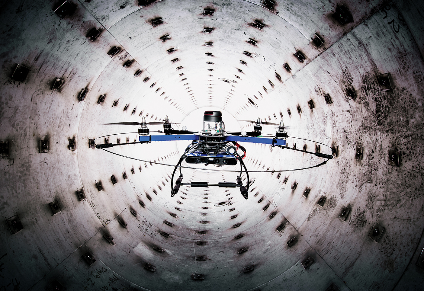
No GPS signal? No problem. Specially designed by BYU engineering students to navigate through covered areas with spotty GPS signals, this quadrotor drone, affectionately nicknamed Leo after the blue-clad Teenage Mutant Ninja Turtle, is the first of its kind.
Mechanical-engineering professor Timothy W. McLain (BS ’86, MS ’87) says most drones will crash without GPS guidance, but Leo’s unique navigational system relies on real-time imaging instead. Depth sensors and cameras create a map of Leo’s surroundings, keeping Leo from running into obstacles a normal drone couldn’t perceive. Leo is designed to inspect critical infrastructure like bridges, dams, mine shafts, or pipes. “Many of these environments are dangerous at worst, dirty almost always,” McLain says. Leo’s next challenge? A test run inspecting the infrastructure beneath LaVell Edwards Stadium.